In this study, the risk from sea level rise to airports has been calculated in terms of route disruptions, using only globally available datasets. The analysis identifies that 269 airports at risk now and this could grow to 572 by 2100. The expected annual route disruptions could increase respectively by a factor of between 17 and 69 by 2100 under the 1.5 °C and 95th percentile value of the RCP8.5 sea level rise scenario respectively.
ABSTRACT
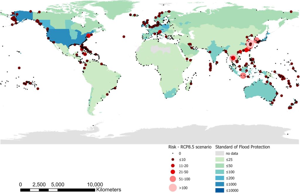
Major airports are already at risk of coastal flooding. Sea level rise associated with a global mean temperature rise of 2 °C would place 100 airports below mean sea level, whilst 1238 airports are in the Low Elevation Coastal Zone. A global analysis has assessed the risk to airports in terms of expected annual disruption to routes. The method integrates globally available data of airport location, flight routes, extreme water levels, standards of flood protection and scenarios of sea level rise. Globally, the risk of disruption could increase by a factor of 17–69 by 2100, depending on the rate of sea level rise. A large number of airports are at risk in Europe, Norther American and Oceania, but risks are highest in Southeast and East Asia. These coastal airports are disproportionately important to the global airline network, by 2100 between 10 and 20% of all routes are at risk of disruption. Sea level rise therefore poses a systemic risk to global passenger and freight movements. Airports already benefit from substantial flood protection that reduces present risk by a factor of 23. To maintain risk in 2100 at current levels could cost up to $57BN. Although the cost of protecting larger airports is higher, busier airports are typically well protected and more likely to have better access to adaptation finance. However, 995 coastal airports operate 5 commercial routes or fewer. More detailed consideration of these airports shows that regions, especially low lying islands, will experience disproportionate impacts because airports can provide important economic, social, and medical lifelines. Route disruption was used as the risk metric due to its global coverage and relationship with direct economic impacts. Further work should collate a wider range of impact metrics that reflect the criticality of an airport in terms of the isolation and socio-economic context of the location it serves.
Yesudian, A. N., & Dawson, R. J. (2021). Global analysis of sea level rise risk to airports. Climate Risk Management, 31, 100266. https://doi.org/10.1016/j.crm.2020.100266